Dutch Road Rage

Dutch Road Rage
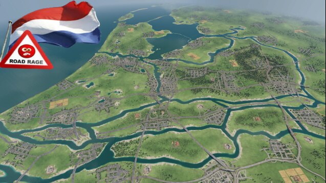
An artistic interpretation of the Netherlands based on a height map.
Scale: Very Large 1:1, Temperate, All vehicles.
+60 cities, +industries, +highways, +rivers.
5 May 1945, Liberation!, now our country needs rebuilding, people need food and construction materials, the capital cities need goods and machines, and factories need tools and fuel.
Most railways have been destroyed due to the war, but the former occupiër has left a great highway network, and time to rebuild basic infrastructures, public transportation, and industry.
Time to restart the economy!
* the yellow diagram indicates our actual railroad lines
* everything on this map is modified in some kind of way;
* realistic roads and highways with their most correct layout (where possible)
* ensuring all roads and connections are fluent and logical provides a smooth pathing calculation for both generic and owned vehicles
* easy tunneling under elevated roads prevents endless road crossings and provides easy acces to populated areas
* cities are prevented (as far as possible) to make irradic random road connections and causing massive traffic jams (also keeps the cpu usage low even with so many destinations)
* rivers and bridges allow ships to go anywhere, and river banks are made for easy port acces
* pre-made location for Schiphol Airport that in time will accept fuel and tools itself as the airport develops
* road rage is clickbait, the cities have a very good pollution and traffic rating!
Good luck, and have fun!


